 |
 |
 |
 |
||||||
|
|
|
|
|
|
|
|
|
|
 |
|
|
|||||||
|
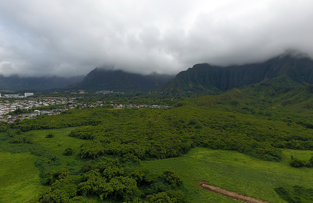
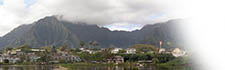
“He‘eia, like the whole Ko‘olau chain, has orographic rainfall,” Kanekoa explains. “The tradewinds blow through and they deliver a fair amount of moist air coming off the ocean. That hits the Ko‘olaus and then it gets elevated up, rises up, and gets colder and colder until it reaches its dew point, when it condenses as clouds and then falls as rain. Very simple system, very efficient. 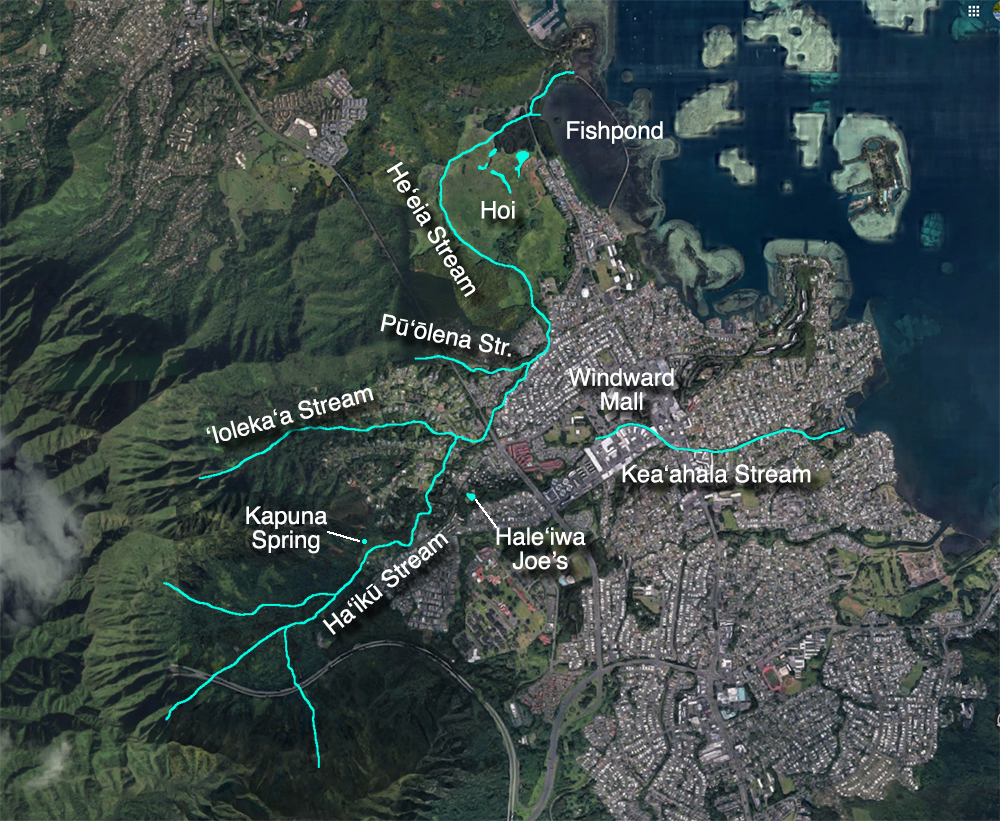
“That’s basically how the rain systems work. O‘ahu’s age is enough where the dikes are still intact. So as it rains, it fills up in the dike systems and it holds a lot of water for us. Those dikes eventually overflow and turn into springs, whether it’s underground or for surface areas. “Climate is going to change that, in that the inversion layer is going to be much different. So those clouds are forming right off of the mountain top right now, the wind is actually coming from the south over the mountain, hitting that, getting thrown up this way, and now the clouds are dropping on this side, being formed right there. “The stream starts back up at Ha‘ikū, way up. There’s two: ‘Ioleka‘a and Ha‘ikū, and they both have streams that feed into this one. And then we have a small tributary called Kalimukele, which flows in this little valley here, but there is a lot of spring water in the stream." 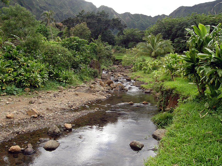
“The water that comes from the mountain, it comes all the way down to Ha‘ikū,” Alice points out. “It’s underneath, now they put road and sidewalk, but they’re all the way down two sides of the street. There’s water goes right down to Kāne‘ohe Bay. All of that was all fresh water from the mountain. It sort of goes all the way down to the lo‘i, because there were three sections at the lo‘i where they are now. “‘Ioleka‘a and where Papahana Kuaola was, people’s houses were up there but everything came straight from the Omega station. So it goes all the way down to the ocean, the water that comes down Ha‘ikū, down to the ocean at Kāne‘ohe Bay Drive, but a lot of it is underground. So on Ha‘ikū Road people really didn’t have to waste water. They got the water from the rivers and the streams going, you could wash cars on the side of the road and everything.” 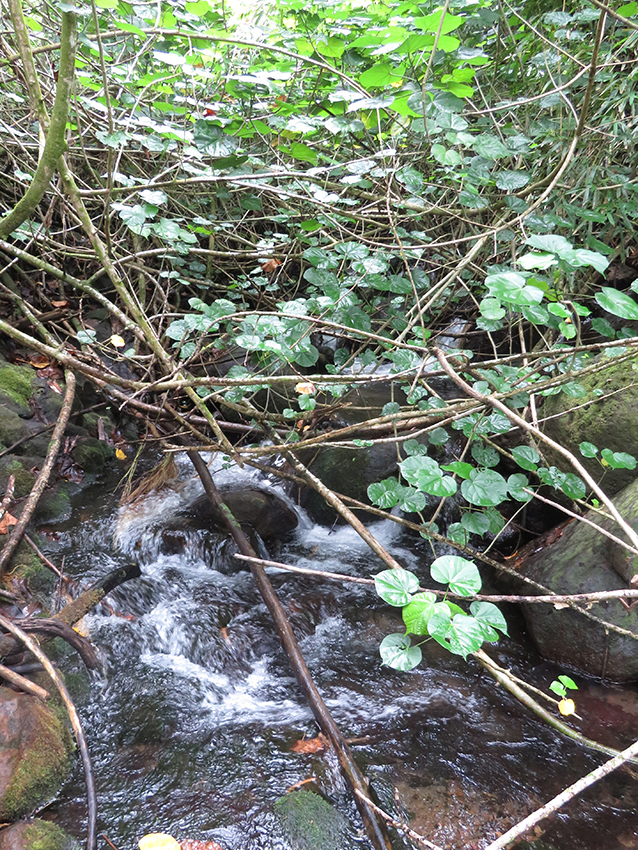
“Our main spring at Waipao is named Kapuna,” Nick Needle states. “It’s an old, old spring. It's recorded in Sites of O‘ahu. Between the time this ‘āina was last farmed and when Papahana arrived here, this whole area became overgrown. The story I was told was that a school group was surveying and exploring this area of Ha‘ikū stream and one of the students found a smaller stream of water flowing into Ha‘ikū. The students followed the stream to its source, climbing through all the Job's Tear grass and brush, until they came upon this spring. "Sometime after the students found Kapuna, Papahana was able to come in with staff and volunteers to cut back the brush and open this space up, making the spring accessible for people to visit and get water. Today a lot of people visit and ask for water from these springs. Often times this water is used for different ceremonial and healing purposes. You can literally drink this water coming straight out of the rocks. 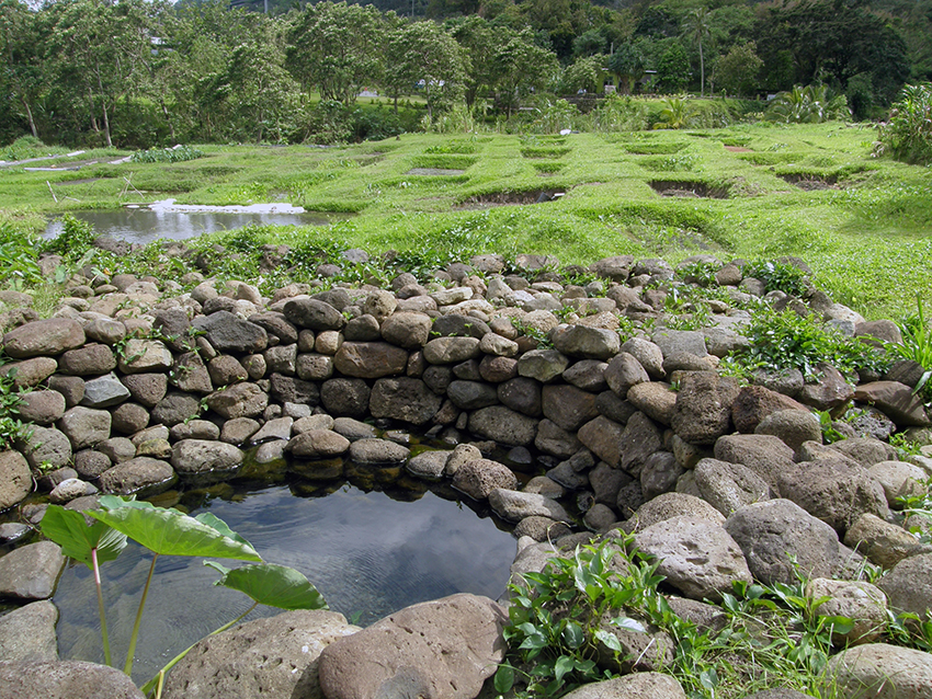
“I don’t know of another place on O‘ahu where one can safely drink water straight from the earth like that. We understand the gravity and the sacredness of that, and we do our best to take care of it and keep these springs accessible for the community. “We’ve hiked up Ha‘ikū stream a couple times from Waipao. If you were to hike up the stream from here, it goes up a long way, and then it starts to fork and branch out into multiple waterways. It becomes very challenging climbing through thick hau bush and branches that have grown over the streams, and you have to deal with a lot of mosquitos. As far as we could tell, there isn’t just one po‘o or source for Ha‘ikū stream. It’s more of a convergence of many streams and waterways coming from the back of Ha‘ikū Valley.” Read about Swimming Holes in He‘eia Water and Taro: “The spring Kapuna makes for a natural site for lo‘i,” Keoni notes. “In our area, Waipao, the water just seeps out of everything. It looks like it’s kind of along a particular contour that the water’s coming out. Kapuna is kind of one end of that contour, and then water just seeps out all the way across that side. There’s a beautiful rock face with water seeping out the bottom of that. And then on the other side of the stream, but more or less a similar contour, we have water dripping out of that side of mountain or side of the hill. How the ‘auwai work at Waipao:
“When we first got there, it was just sort of a wild spring. In the time since—and as we perfected our dry-stack masonry skills—the crew has built up a wall around Kapuna." Nick Needle on the meanings of "Waipao" 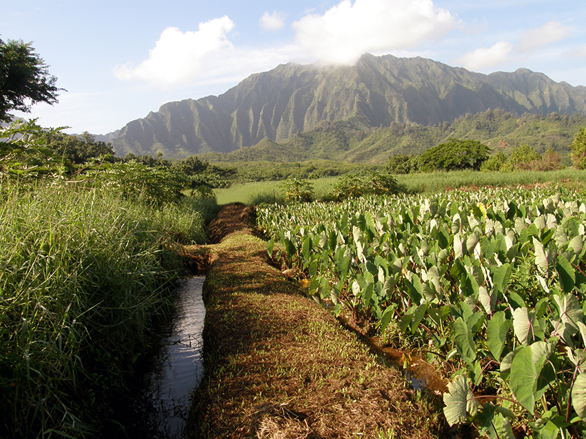
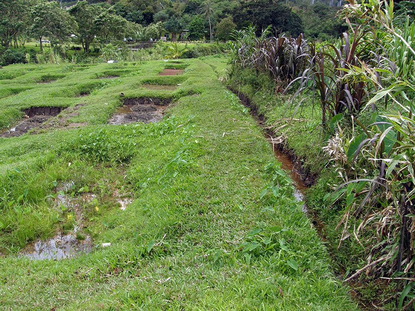
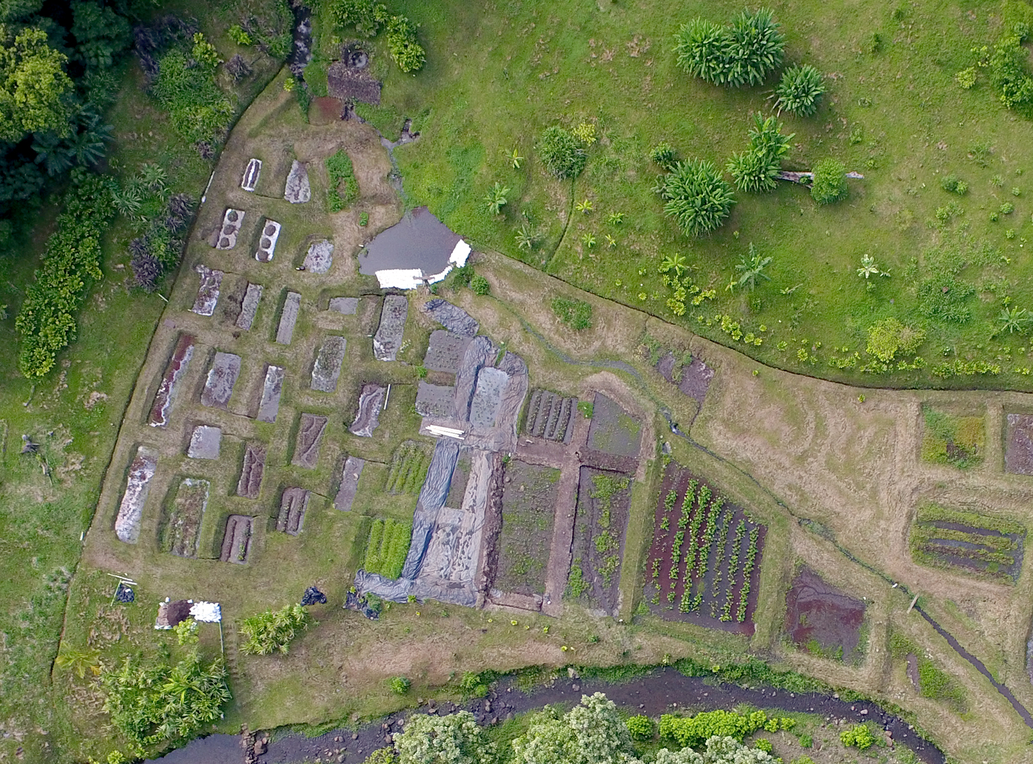
“We have a couple of ‘auwai,” says Kanekoa. “The main ‘auwai is called Wing Wo Tai. It’s a pake name, the Chinese have basically registered it, so they’re registered under the version as Wing Wo Tai. And that runs along from the upper stream down to the channel and ends right over here. So the Wing Wo Tai actually spread open as flood channels came in and pushed it open, but this area technically is still considered a diversion flow. "The main stream loops down, comes through the mangrove, and then comes through there. And so, when we clear six acres of mangrove, we’re going to see the channel and want to revitalize that first, and then we’ll go forward with that. And it’ll really ensure that we hopefully become a better lāhui. “Kāko‘o is not requiring a lot of water. We don’t have the luxury of the waiwai, we don’t have this huge, flowing water system. We’re very ponded and stagnant. It’s higher labor, but still a very beautiful system.” Read about waiwai and notions of “wealth” “We didn’t have our own wells,” Emalia says, of her family’s land near Nā One a La‘a. “There was a bit of water that came from the mountains down to my grandfather’s place, which is what nurtured the lo‘i. He had a small patch, maybe about three quarters of size of this room. “Water was very important because he had a limited supply of it that came to him. Once people started building houses above us, then they cut off that water supply. But by that time, Tūtū was gone. So to me, once you lose access to land and water, it really cuts off your Hawaiian life. It does because that’s really the basis of how you exist. You need water first of all, and you need land.” Freshwater Animals: “We have ‘o‘opu in the near-shore area,” Kanekoa says. “We’d like to see ‘o‘opu return here again but we’re just not there yet. Hihiwai, there are hihiwai up above, but we know that the way the system is here might not be conducive. They might not be able to cross through our patches yet.” 
“We never did catch ‘o‘opu,” Alice remarks. “We see crayfishes in all the lo‘i. I don’t know. And we never got sick. We used to cook them right there by the lo‘i, everybody bring them and put them in a fire that they make. Everybody eating and we never got sick. Now you cannot eat the crayfish. They say something with the water but no, no. What we could do in the old days, you can’t do now and what we had in old days, they don’t have now. “There was a little stream before the pond and I think where they fixed up the pond they took away the stream. They should not have done that because the freshwater and the saltwater meets, so they go back and forth and different types of limu and ‘ōpae and other stuff grew in there. But that was a long time ago, too bad. Nobody told me, or I would have told them don't do that. It’s paved, all paved. It’s paved right across the street. Right to where it flows into Kāne‘ohe bay.” “In the estuarine areas, there’s still some native shellfish and stuff like that,” Rick says. Not in huge abundances, but they are there. There’s a lot of clams in the water, but there’s also introduced bivalves.”
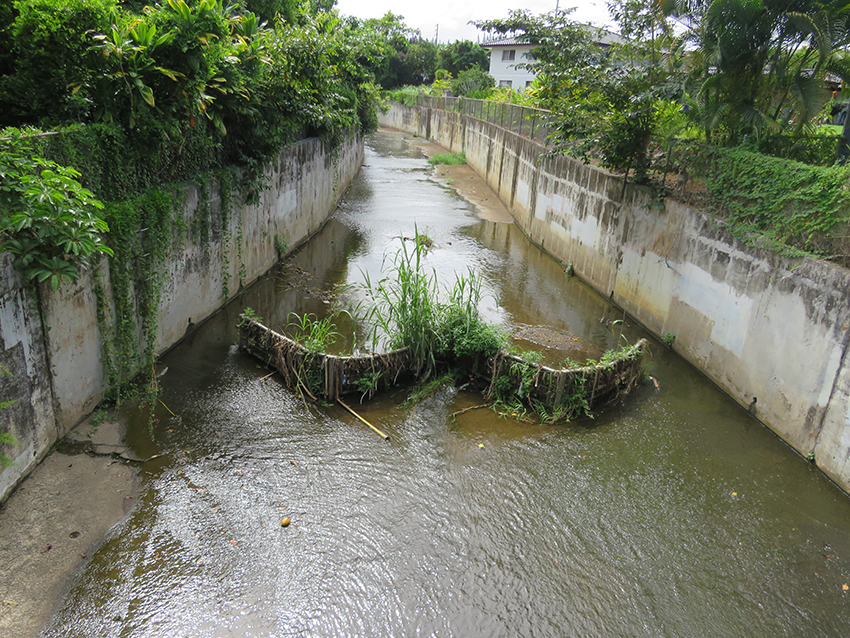
“I remember Windward City, my mother had a beauty shop there,” Lilikalā recalls, “and there was a little river that ran through it, kind of right where Longs is. There was a little stream that came across the road and came down there. There was the clay hillside that they cut away in order to make the area flat enough for the shopping center. There was a little cave. We used to go play over there, pirates or whatever. “I think it was about 1963 when they put in all the concrete into the riverbeds. So now, they put in concrete channels to keep them from flooding, supposedly. I remember one day, my mother had moved her beauty shop. It was kind of near where Pizza Hut is today on the makai side of the road, and there was a little stream nearby. I used to go with my mother to the beauty shop. If I got time to run away, I would go play in the stream, look at the fish, and just hang out. I loved the stream. “And then one day, I came home and it was all concrete. It was so horrible. It was such a shock. I couldn’t believe it. Why would anybody destroy such a beautiful stream and make it concrete? And that concrete really needs to come out because it damages the amount of water going into the aquifer. It’s on my list of things to do! 
“We’ve looked at these old maps from like 1913,” Rick says, “and this upper portion above Kahekili Highway is pretty much the same as how it was before. Below Kahekili Highway, there’s a waterfall, Makawiliwili, and then that goes into the stream. And then from there, through the residential area, the upper portion of it looks natural. "Then it gets into the really more residential by Alaloa Street down below, and then it gets more channelized. And then there’s these concrete channelizations wherever there’s bridge work going on. And with that, yeah. So up here, we’ve done a lot of stream restoration on our property too, riparian restoration. “You would think how clean and how oxygenated it must be. It looks like the most ideal situation for ‘o‘opu up here. There’s hardly any ‘o‘opu. There’s hardly any native biota in our streams on this portion of it. It looks ideal for it, but it’s overrun with armored catfish, mosquitofish, Tahitian prawns and grass shrimp. “All of our native freshwater fish are anadromous, so they’re like salmon. They’re not truly freshwater fish. They spend their adult life in freshwater streams, but when they are born they actually have a larval stage out in the ocean, and then they have to migrate back up into the streams. 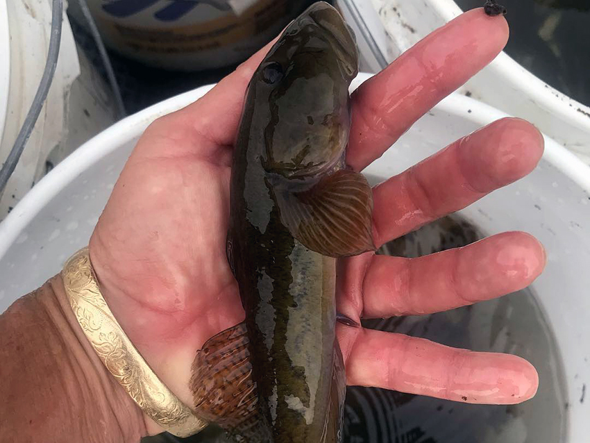
“All of that channelization in the residential area is caused overheating of the stream water because of the concrete. That’s not conducive to our native freshwater fish. And then in the Kāko‘o area, before they started doing their restoration work, sediment load upon sediment load was just going into the streams, areas were being blocked off by invasive grasses. There was just a lot of vicariance in the sense that fish couldn’t migrate anymore. “And if they did, it was very difficult. That’s the same situation in all of our streams, especially on the Leeward side. All of these concrete channels displace the water. A stream originally five feet wide and three feet deep is now spread over a 20-foot wide area and it’s like an inch deep. And it gets super-heated, and there’s nothing native that can pass through that because it gets hot. “A simple solution: Make a low-flow channel inside of that just to make the water column deeper. It’s all you got to do. They don’t do that.”
|
|
|||||


|
|
|
||
|
|
|
||

|
 |
||||
|
||||
Copyright 2019 Pacific Worlds & Associates • Usage Policy • Webmaster |
||||
