 |
 |
 |
|||||||||||||||||||||
|
|
|
|
|
|
|
|
|
||||||||||||||||
|
|
|||||||||||||||||||||||
|
|
|
|
|
|
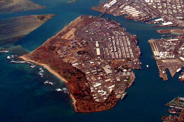
| “Originally there was a natural harbor right in front of what we now call Honolulu,” John Clark explains, “and the early sailing ships that came here found there way into that harbor, so that they could anchor and not be exposed to the surf offshore. There was a natural, shallow reef there. But when there was surf, there were still waves and current and movement that crossed that shallow reef and rocked the boats, so Sand Island was developed as a barrier between the open ocean and the harbor inshore, just to make it more peaceful, more stable, and better suited for anchored boats."
|
||
|
|
||
|
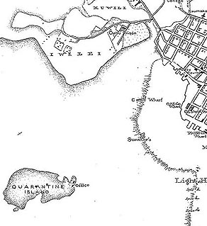
“If you go on the ‘Ewa side of Sand Island, there are all these little tidal islands out there. Mokuauea is the name of the largest one, but there are a number of others, even along Kalihi Channel, which is the other channel besides the main entrance channel. "In the early days, when there was a quarantine for ships coming into the harbor, people were quarantined on what was called Quarantine Island. It too was just a small tidal island that sat on the reef just outside of what we call Downtown Honolulu. "But Quarantine Island just got absorbed—it actually got landfilled over when the harbor dredging started in earnest in the 1940s. All the spoil material from the dredging was being pumped on top of that reef into what we now call Sand Island, and Quarantine Island just disappeared."
|
|
|
“But if you go back to the early E.H. Bryan maps, he kept a little oval in the middle of Sand Island that he’d labeled Quarantine Island, just because he knew the history of it, and he was trying to retain that. "Mokuauea, as far as I know, was already there. It was the largest of these natural islands that were in Ke‘ehi lagoon and fronting Honolulu Harbor.
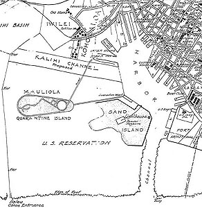
1920 map shows the development of the harbor area, with Mauliola—Quarantine Island—being subsumed into the new Sand Island. Note in the lower left corner a "canoe entrance" is designated.
|
|
|
|
|
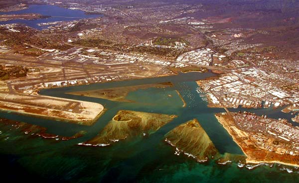
“A triangle of channels were dredged in the reef as part of the war effort. These were seaplane runways. And when they dredged these, they actually took out another one of these large tidal islands that was there in the lagoon. They just dredged it out, and it just disappeared — and there were people living on it. It was not as big as Mokuauea, not as many families, but there were people on the island that were displaced because of the war effort.”
|
||
|
|
||
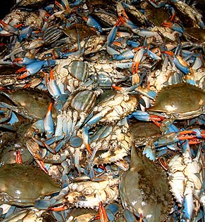
| “My father called this reef one of the most productive reefs that he’d ever seen anywhere in Hawai‘i,” John recalls. “He said the fish, and the crabs and the lobster were just phenomenal in there. They were dredging into really shallow reef, and then all of the dredged material ('spoils') would come back up and go into a pipe system which piped it onto the land. "And he said that the crabs and the lobsters coming through the chute were more than they could ever handle. That was because the Damon family had the konohiki rights there, and they guarded them very carefully. No one was allowed to come in and fish, so this reef was a very protected area, and probably one of the most productive reefs that we had here in the islands."
|
|
|
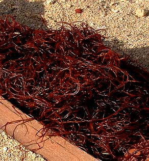
“Besides being productive for fish and crustaceans, there was a lot of limu (seaweed) out there too. I’ve heard from a lot of people that they used to pick manauea out there. The reefs were loaded with it, from Sand Island all the way down to Kalihi Channel. But it’s all long gone. It’s all been stripped, and pulled, and killed off by all the pollution too. I don’t know what’s left out there now. “As I’ve talked to a lot of the older people over the years, I came up with what I consider to be like a subset of place names, because gathering places in the sea were all named. There’s Hale-weke, and One-awa, and Ulua-awa, and all of these places where you went to harvest certain things. It was all out there, Luahole, Luaawa, all the holes where the fish were found."
|
|
|
|
A major event that took place on the reef is the settlement of Hawaiians and their later eviction by the State. Information on this event is forthcoming, as is information on fishing.
|
||
|
|
||
| |
| |
|
|

|
| Nu‘uanu Home | Map Library | Site Map | Hawaiian Islands Home | Pacific Worlds Home |
|
|
|
|
|
|
|
|||
| Copyright 2003 Pacific Worlds & Associates • Usage Policy • Webmaster |
|||