 |
 |
 |
 |
||||
|
|
|
|
|
|
|
|
|
|
|
|||||||
|
|
|
|
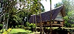
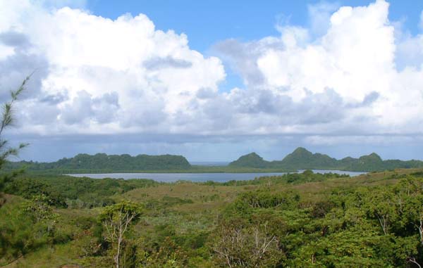
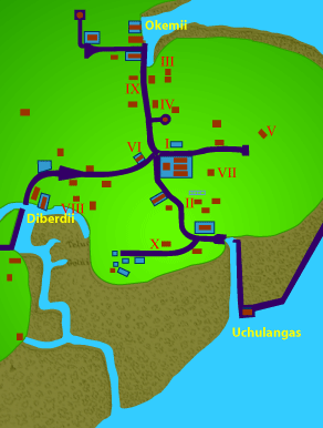
The peninsula where Oikull and Ngerduais villages are located.
|
|
"In the past, villages were pretty much inland, closer to taro paddies and closer to the forest." Noah explains, "during the Japanese period, about 1920-25, villages began the movement from inland to the coastal areas, where they were allowed easier water transportation. This was the time when Palau was being developed by the Japanese. Now most or all of the villages are along the coast of Babeldaob and the rest of Palau. So that’s basically the last 50 years."
|
||
| |
||
"Women are responsible for the land part—the taro patch—but the men always do the sea. It’s always been sea for Palauan men, traditionally that’s their domain. So everything from training for warfare, to fishing, to folklore and such is a domain of men. They had very close knowledge of the sea, even when they were inland. The coast was heavily controlled because of warfare. "Villages would have a pier or a water trail or a place where they would come out for fishing activities, so there would be a designated area for people to come to the sea. You have a designated area in front of the village where they would have all the activities."
|
|
|
"Fishing was not an individual venture. You don’t go from your place and just go out and go fishing. There was a designated fishing port or staging area where everybody go through and go out, and come back. That’s also to make sure that people were accounted for, the people that go fishing, so if somebody doesn’t return, then a search party will go out. "Now it’s very different you know, we have people with individual boats, probably tied up in front of their houses, or separate water trails or separate accesses. But in the past it was pretty much in the village, where central access to the sea would be somewhat controlled."
|
|
|
|
|
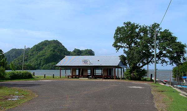
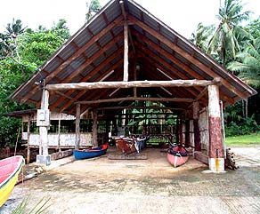
"In Airai village, they have the main landing place for that particular village, but now in addition to that, they have other people putting their boats everywhere on trailers, on the marinas, on the other sides so you no longer have that central focus. Airai is one of few villages where, for that particular village, it is still very centrally located. Melekeok is the same way: they have a landing place, and pretty much everything revolves around the landing place. That’s how it once used to be, and of course before it was just a stone pier. Then you go up the trail to the village."
|
||
|
|
||
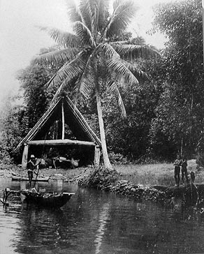
"A canoe house would be a place by the landing place, we call it diángel. It would be a public place, where people would mend their nets or they work on their canoes, and that’s a place that provides for stories and training and for central activities. That would be a men’s place. "All men would be in the canoe house, and the elderly men would be fixing nets or telling stories while the young men would go fishing and come back. So everybody knew what was going on at any given time."
Palauan Boathouse. Photograph courtesy of the Northern Marianas Museum, Saipan. |
|
|
"Women would be allowed only to pass through for transportation—for purpose of transportation, landings and going uphill, and for departure, but certainly not to be sitting there talking stories with men. "Now it’s paved and the boats are different, and they probably don’t know who’s out except when they go out. There’s no organized kind of watch there all the time, whereas in the past there were organized persons there all the time so they knew who’s out there and who’s not, and where they went."
|
|
|
|
"We have coastal gathering activities. There is a lot of shellfish that are edible, and women do the collection. There’s small clams right on the beach sand, and all the way down, there’s all kinds of creatures: cockles, snails, clams, sea cucumbers, sea urchins, all the way to giant clams, more on the sea grass plus on the rocks, so all the way to where the low tide, women will come and go gleaning on the reef, in certain seasons. "And then toward the mangroves, we have these sort of clams that women gather. Just outside of mangroves, very delicious clams that are quite highly prized here, so the women will gather that."
|
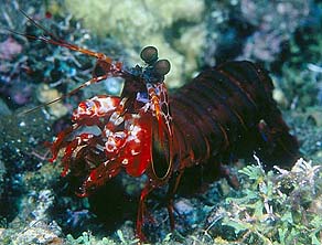
Mantis Shrimp. Photo by Ethan Daniels.
|
|
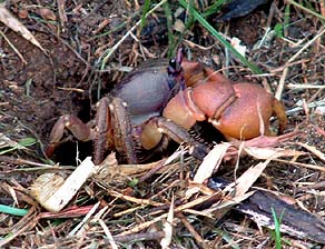
"The crabs, of course, the women do the trapping. They go check the holes, and so the crabs are collected. Same thing with the mantis shrimp, it’s quite big but they also collect them. And when there’s a full moon, there’s land crabs that come out a few days after full moon, species of land crabs come out, so they all know all the times for these and it’s different from season to season. During the easterly season, it’s different than the westerly season. "All this is known about the seasonal abundance of things, so there will be a time for collecting certain things and that’s mainly done by women and kids."
|
|
|
|
|
More such gathering activities take place in the mangrove forests that line the shore in place of beaches.
|
||
|
|
||
|
|
|
|
|
|

|
| Airai Home | Map Library | Site Map | Pacific Worlds Home |
|
|
|
|

|
 |
|
|
|||
| Copyright 2003 Pacific Worlds & Associates • Usage Policy • Webmaster |
|||