 |
 |
 |
|||||
|
Agriculture in Mānoa Valley:
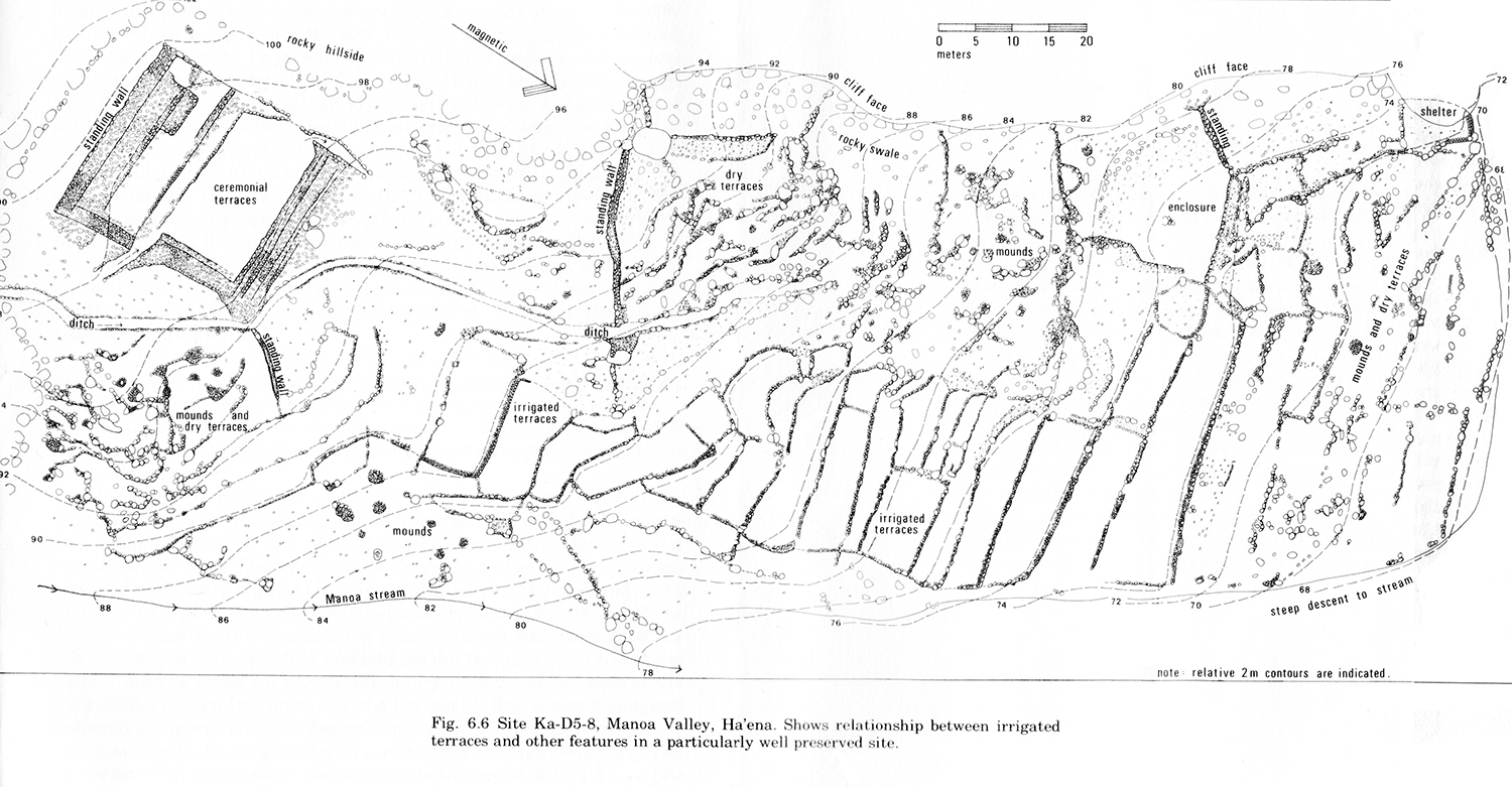
“As you splash Mānoa stream as you go by Maniniholo cave," Chipper says, "if you go up Mānoa valley, it’s a very shallow valley. There is a lo‘i complex that was developed within that valley, and also, there’s a heiau up in there. It was an important cultural area, but a relatively small one within the ahupua‘a of Hā‘ena. It’s hard to see anything there now, because the ‘awapuhi and stuff is all growing, and its covered everything. You go back there in the winter, and a lot of the ground cover has died back, and you can see the wall structures a lot better.” Archaeologist Timothy Earle explored Mānoa Valley in the 1970s. He wrote that “in the major pondfield cluster, there are thirty-three well-defined terraces (total area, 2409m2) and another 5583 m2 which may have been irrigated. The main terraces form a narrow stairlike series of tiers with one or two pondfields per tier....Most of the water for the pondfield series appears to have been fed directly to the top patches and then to have flowed down the pondfield tiers. “In addition to the irrigation features, there were various dry-farming, habitation and ceremonial features associated with the site. Features which strongly suggest dryland farming are located along the periphery of the pondfields.” He also found “two complexes of dryland agricultural features located to the west of the mapped area. First, on the steep hillside that hangs above the site, there is an irregularly scattered series of of about sixty to seventy-five unirrigated terraces....Second, in an intermittent water channel on the hillside, there are five small terraces....” The map and description attest to the intensity with which this small valley was put into production. One could say that Mānoa Valley returned to its role of providing food in the 1960s. When an area nearby adjacent to what is now Hā‘ena State Park was taken over by hippies in what became known as "Taylor Camp," Mānoa Valley was known to the inhabitants as "Mango Valley." Today mango and guava trees dominate the forest of Mānoa.
|
|
|||||
|
|||||
