|

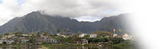
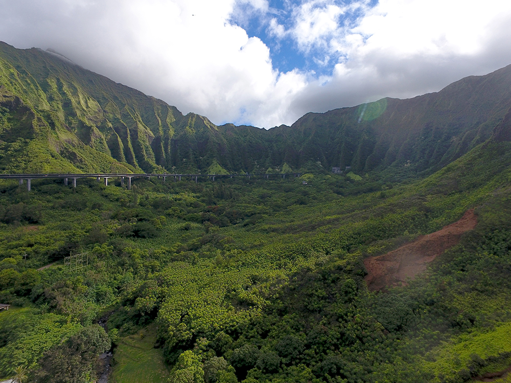
View across the floor of Ha‘ikū valley to the pali in the back, from the vicinity of Waipao. A red landslide scar is on the right.
"If you want to go back in time to what this area looked like," Rick says, "the very tippity-tip-top, it would be considered a rainforest or a wet forest. That’s based off of precipitation. The type of substrate doesn’t allow for big trees because it’s on a ridge. So a lot of the trees that you see up there are either dwarfed out or they don’t form a canopy. It’s really the understory that’s dominant.
"We got pali, and then we got mesic forests. And then you got a mixture of wetland and dry forest. And then the dry forest probably would have extended all throughout what we would call the Windward Mall area and Kāne‘ohe, the main flat areas away from the foot of the mountains. So everything within the valleys probably would have been mesic."
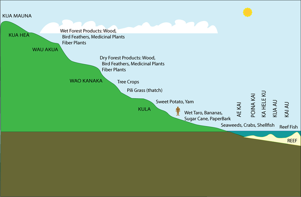
Hawaiian language has many names for different landforms and environments. Some of the most commonly used names today include kua mauna (mountaintop), wao akua (forest of the gods), wao kanaka (forest used by people), and kula (plain, field, open country, pasture). Where each of these would extend would depend on the rainfall and topography:

A simplified chart of some common Hawaiian area terms.
Once beyond the valley and into the coastal lowlands, the wetlands of Hoi become prominent.
"This large wetland was naturally here," Kanekoa points out. "And then when our ancestors came into being, the land was converted to taro. And probably freshwater fish ponds above and freshwater fish ponds below, and then brackish-water fish ponds below those freshwater fish ponds. This gave them the ability to produce a fair amount of food. And for the species that did survive with our people, it provided them habitat to exist and live in.
"I think throughout the whole area, it was a living zone. Throughout the whole parcel. Different families had different strengths. They would live in different areas. We knew the population was large considering the size of the fish pond, so there’s a really good indication that this area was abundant with life and people. Just the fish ponds and the taro patches alone show that it could still produce a fair amount of carbohydrate and food."
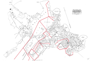
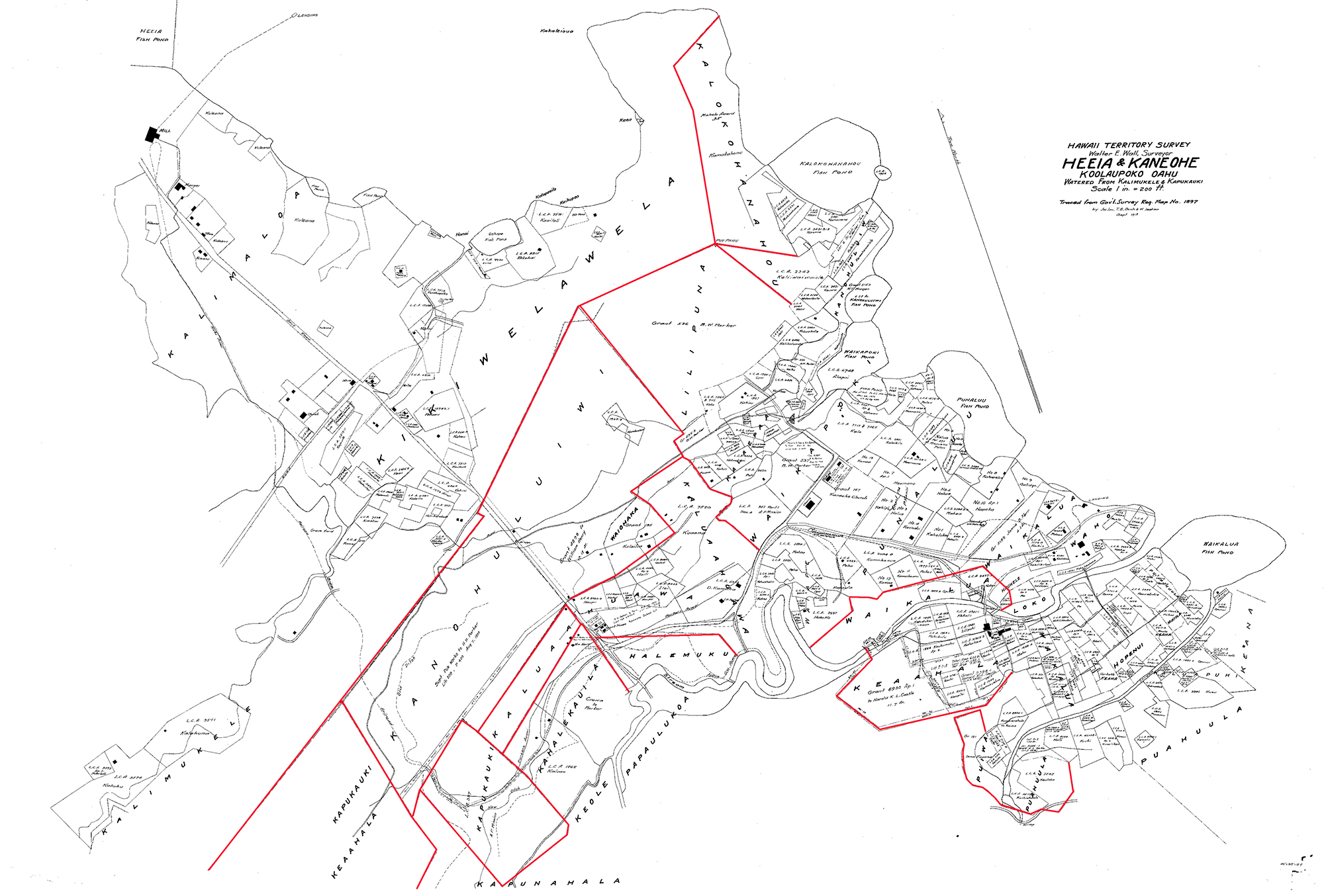
Most inhabited areas were subdivided into ‘ili ‘āina, "strips of land." This 1897 map shows many of these names. A few of the discernable borders have been highlighted.
"The core of our ‘āina is Waipao," Keoni says. "It’s an ‘ili ‘āina [a small land subdivision] of He‘eia. It’s not all the‘ āina that we care for. Waipao doesn’t extend to the ridge side. It doesn’t extend certain areas. I think we’re just aside kula lands. Given the topography, I don’t see our ‘āina as kula, I see most of what we have as definitely wao kanaka, except going up onto the ridge. I would consider that wao akua.
"Our property goes up ‘Ioleka‘a ridge. And just over the ridge, along the ridge trail, there are some really nice stands of native plants. If you want to capture some of the forest in our area, I think that would be a nice place to see, where there still flourishes some native stands."
|