 |
 |
 |
|||||
|
|
|
|
|
|
|
|
|
|
|
|||||||
|
|
|
|
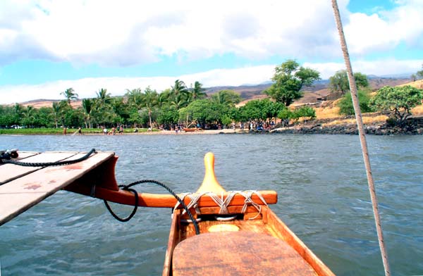
Arriving at Pelekane Bay.
|
"It is certainly is conceivable that Kawaihae would have been one of the earlier places settled on that coast," says Hannah, "but I don’t know of an archeological record that reflects the earliest settlement. Most of the archaeological attention that has been paid to Kawaihae has been after the harbor was put into place. But that certainly is a reasonable conjecture, because you’ve got all those resources in fairly close proximity."
|
||
|
|
||
"Looking at Kawaihae, whether through an Anthropologist’s eyes, or a cultural Geographer’s eyes, there are certainly a number of conditions that make it the sort of place where a royal center might be situated. "The gulch that runs intermittently now probably ran with greater regularity in the past, when the watershed was more intact. We know that up near Waimea is a heiau which is believed to have been used to regulate the waters flowing out of the watershed."
|
|
|
"Below there are the remains of lo‘i kalo [taro patches]. If we were to go out in that landscape even today, we could find the ‘auwai which feed off the stream and feed into these lo‘i kalo, and find where the water is returned again to the stream. So we have places with fairly close proximity to Kawaihae where kalo was cultivated. "Further down the slope, from the top of a pu‘u named Kehena, we can see literally miles of sweet potato mounds stretching out in either direction. So we have carbohydrate production close to Kawaihae."
|
|
|
|
Part of the reef off Spencer Beach, Kawaihae.
|
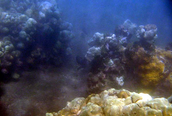
"And Kawaihae still remains a rich reef. If we can imagine the landscape of the beach before the harbor was constructed, we can have an idea of the productivity of those reef flats. We have names indicating the presence of the shark population and if we go down to Pelekane Bay early in the morning, we can see the reef sharks cruising, and we learn from the history of that area of Hale o Kapuni, the heiau that was built on the reef flats there. "A popular history associates that place with Alapa‘i-kupalupalu-mano. We have this notion, with people of chiefly rank, of there being no separation of church and state: that our political leaders were intimately involved with the kinolau or the body forms of the ‘aumakua and the akua as they appear to us in our cultural landscape." "So, we’ve got water, we’ve got vegetable crops and we’ve got protein from the sea. Everything is in place there to have the sort of resource supply that would make it a desirable place for chiefs to come and congregate."
|
||
|
|
||
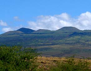
"The mountainside is not a difficult grade to ascend, and rather quickly we’d find ourselves in the forest. Certainly in times of old, the forest had a lower margin, so quickly we’d find ourselves in an environment that could supply additional material needs, like wood for housing as well as for fuel, thatch for housing, and other forest resources. So Kawaihae is well situated." "Long before European contact, the middle slopes of that whole South Kohala, or leeward side, were one of the most productive agricultural zones," Sam explains. "That whole mid-slope agricultural system is really famous in the archaeological studies. In fact, even now they’re revisiting some of those sites to try to figure out why a system as dry as that would have been so good."
|
|
|
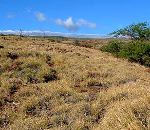
"They found that between certain rainfall conditions—not too wet, because if it’s too wet, the rain leaches the nutrients out; and not too dry, because at too dry, you don’t have enough water for agricultural—but in the middle zone, it was extremely rich. And each of those ahupua‘a would have had a piece of that very rich agricultural zone, along with, presumably, rich coastal resources. These are the upland field systems of Kohala. "In post-contact times it would have been Irish potatoes, grown up there. There was a lot of conversion of lo‘i from kalo to rice and from sweet potato to potato. But it’s quite clear that a lot of those field systems are much older than contact days. It would have been dry kalo and ‘uala."
|
|
|
|
"Also, as we move closer to our time in history, Kawaihae has that close proximity to Maui," Hannah notes. "So in those dynastic challenges, sometimes occurring between cousins, it was perhaps the easiest place to land a warring party, or for a warring party to depart from. That tradition continues into the Kamehameha era, from which we get most of our information." "Kohala certainly is one of those places that were first occupied in the time of Umi and Liloa’s occupation of Waipi‘o," Sam adds, "and the Kohala chiefs were long prominent on the island of Hawai‘i because of the antecedent chiefs coming out of the Kohala mountains."
|
||
|
|
||
These speculations are taken further in a consideration of the ancients that once occupied this area.
|
||
|
|
||
|
|
|
|
|
|

|
| Kawaihae Home | Map Library | Site Map | Pacific Worlds Home |
|
|
|
|
|
|


|
|
|||
| Copyright 2006 Pacific Worlds & Associates • Usage Policy • Webmaster |
|||