 |
 |
 |
|||||
| Location of Kawaihae | |
|
|
Kawaihae is located on the island of Hawai‘i, known locally as the "Big Island." This term is used particularly to distinguish the name of the island from the name of the State. It is said that since the contacts with early explorers took place mostly on this island, the name "Hawaii" came to be used by Westerners to refer to the entire archipelago. This is a typical cultural confusion over place naming. They would ask, "what's the name of this place," in their minds meaning the whole island group. But indigenous peoples rarely have such overarching place names. So here, the islanders answered with the name of the island where they were: Hawai‘i.
|
||
| |
||
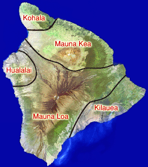
Hawai‘i is the youngest of the eight major islands that make up the Hawaiian chain. It is comprised of five volcanoes, ranging oldest-to-youngest in a diagonal line from Kohala to Kilauea. Western science explains these islands as being caused by a mantle plume or "hot spot" in the earth's mantle, where the thin crust allows lava to spill out onto the sea floor in a relatively gentle, non-explosive fashion. The result is "shield volcanoes" that are enormously wide for their height. Of the five volcanoes that make up this island, all are considered potentially dormant, but not extinct.
|
|
|
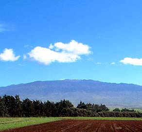
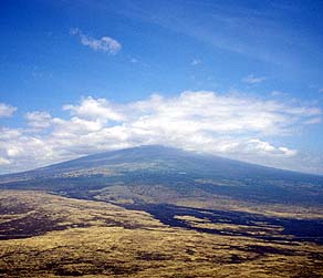
Mauna Kea, "White Mountain," is the highest peak on the island, at 13,796 ft (4,205 m). The name refers to the snow that rests on her summit during the winter months. The U.S. Geological survey (1997) reports that "Mauna Kea has erupted several times in the last 10,000 years, most recently about 4,500 years ago. This volcano is considered dormant but not extinct." Many astronomical observatories reside at the summit, where the high elevation and distance from sources of air pollution make for ideal viewing conditions. But Hawaiians consider this a sacred place, and conflicts over further development have arisen. |
|
|
|
|
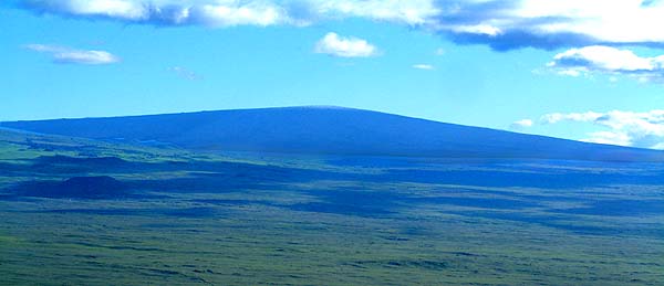
Mauna Loa is said to be probably the largest single mountain on the face of the earth (see Macdonald and Abbott, 1970: 54). It rises about 29,000 feet from its base on the ocean floor, and then another 13,667 feet above sea level. Mauna Loa is an active volcano, having erupted in historic times.
|
||
|
|
||
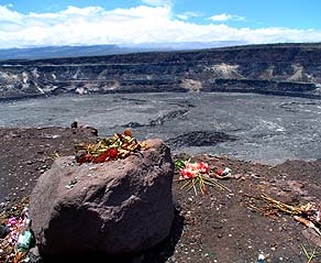
Kilauea is the most currently active volcano in the islands, and perhaps the most active volcano in the world. Rising to only 4,190 ft (1,277 m), it is still in the shield-building stage, with gentle slopes and a deep caldera. The fire pit Halema‘uma‘u ("fern house") sits within the larger Kilauea caldera, and is the home of the volcano goddess Pele. Here she came to reside amidst the flames, after working her way down the island chain from Kaua‘i, looking for a suitable home. The presence of Pele on the island is a powerful Hawaiian cultural element of here. Pele is said to have replaced an earlier, male volcano deity, ‘Ai La‘au, or "forest eater." But like her predecessor, Pele still consumes forests on the island with her lava flows.
|
|
|
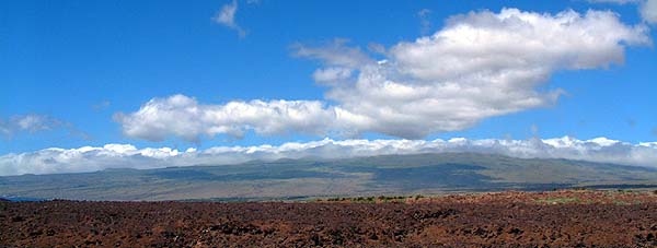
On the Western side of the island are the less well known volcanoes of Hualalai and Kohala. Hualalai rises to 8271 ft (2523 m) above sea level and is also considered an active volcano, its most recent eruption occurring in 1800-1801. Sitting downwind from the flanks of Mauna Kea and Mauna Loa, the bulk of Hualalai further blocks the tradewinds from reaching the Kona coast. Consequently, warm air rising off its sun-heated southwestern flanks draws air in off the ocean, in the direction opposite to the tradewinds, resulting in a build-up of clouds by the afternoon.
|
|
|
|
|
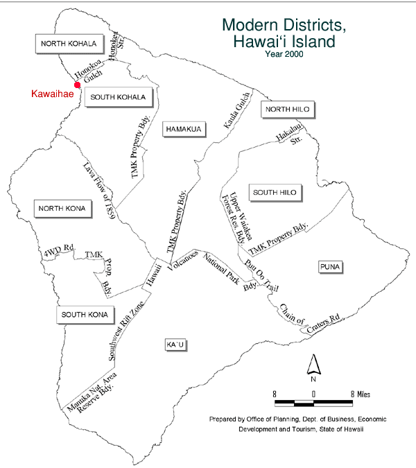
Kohala is the oldest of the five visible volcanoes that make up the island of Hawai‘i. Though she has not erupted in recent times, geologists are hesitant to call her "extinct." At 8271ft (2523 m) above sea level, Kohala's long shape stretches towards the Northwest, in the direction of Maui, and lies almost perpendicular to the trade winds. Thus the more populated windward side and the sparse leeward side are dramatically different. Kawaihae lies are the juncture of the Kohala shield and the Mauna Kea shield, in the district of South Kohala. There are actually two ahupua‘a of Kawaihae, and the village lay across the boundary between these two. This study considers both of these ahupua‘a together as comprising "Kawaihae."
|
||
|
A closer look at the ahupua‘a of Kawaihae continues on the next page, Orientation.
|
||
|
|
||
|
|
|
|
|
|

|
| Kawaihae Home | Map Library | Site Map | Hawaiian Islands Home | Pacific Worlds Home |
|
|
|
|
|
|
|||
| Copyright 2006 Pacific Worlds & Associates • Usage Policy • Webmaster |
|||

