 |
 |
 |
|||||||||||||||||||||
|
|
|
|
|
|
|
|
|
||||||||||||||||
|
|
|||||||||||||||||||||||
| Getting to Nu‘uanu |
|
|
|
|
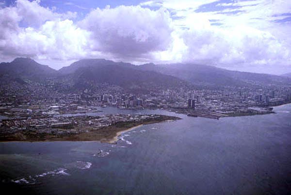
Today most people travelling from outside the Hawaiian Islands would arrive by plane at Honolulu International Airport, the major airport serving the Hawaiian Islands. This large airport includes the "reef runway," a runway built on an artificial island created on the fringing reef of O‘ahu's southern (Kona) coast. The airport lies on the edge of Pearl Harbor, famous home of the US Pacific Fleet. It is a direct ride from the airport to Nu‘uanu. Two highways will take you there. Nimitz Highway follows the coast, and leads into the waterfront of Honolulu, then on to Waikiki.
|
||
|
|
||
|
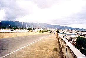
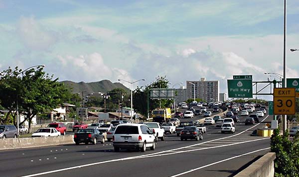
H-1, an "interstate" highway, takes a slightly more inland route, and connects more directly with Nu‘uanu. Many people ask how Hawai‘i can have Interstate Highways. Under Federal law, Federal Highway funds can be used to connect military bases. All three of Hawai‘i's Interstate highways run from one military base to another. H-1 runs from Pearl Harbor to Diamond Head crater in the ahupua‘a of Waikiki. Diamond Head was once a military installation. It is one of several prominent craters that adorn the Honolulu area. The highway can be either fast or slow, depending on the time of day. Either way, Nu‘uanu lies only a few valleys down from the airport.
|
|
|
|
|
|
|
|
|
||
|
You know you are approaching Nu‘uanu when the crater of Puowaina, commonly called "Punchbowl," looms suddently into view. Punchbowl marks the far edge of Nu‘uanu , but lies within Honolulu ahupua‘a.
|
||
|
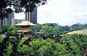
This automobile journey takes perhaps half an hour from Honolulu airport (depending on "rush hour" traffic. Because one is travelling fast, one might not realize that the junction of H-1 and Pali Highway also marks a division between bustling downtown Honolulu on the makai (ocean) side, and the lush and quiet Nu‘uanu valley on the mauka (mountain) side. It is this juxtaposition of the modern urban environment with the traditional and historical landscape that characterizes Nu‘uanu. High-rise apartment buildings and freeway ramps mix with old Japanese temples, schools, and monkeypod trees. Fast transportation or clogged traffic give the Honolulu area a character far different from the gentler regions of this and other islands. Now you are ready for your arrival.
|
|
|
|
|
| |
| |
|
|

|
| Nu‘uanu Home | Map Library | Site Map | Hawaiian Islands Home | Pacific Worlds Home |
| |
|
|
|
|
|
|||
| Copyright 2003 Pacific Worlds & Associates • Usage Policy • Webmaster |
|||