|
 Territory
 |

|
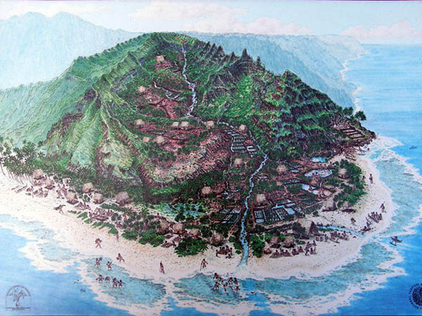
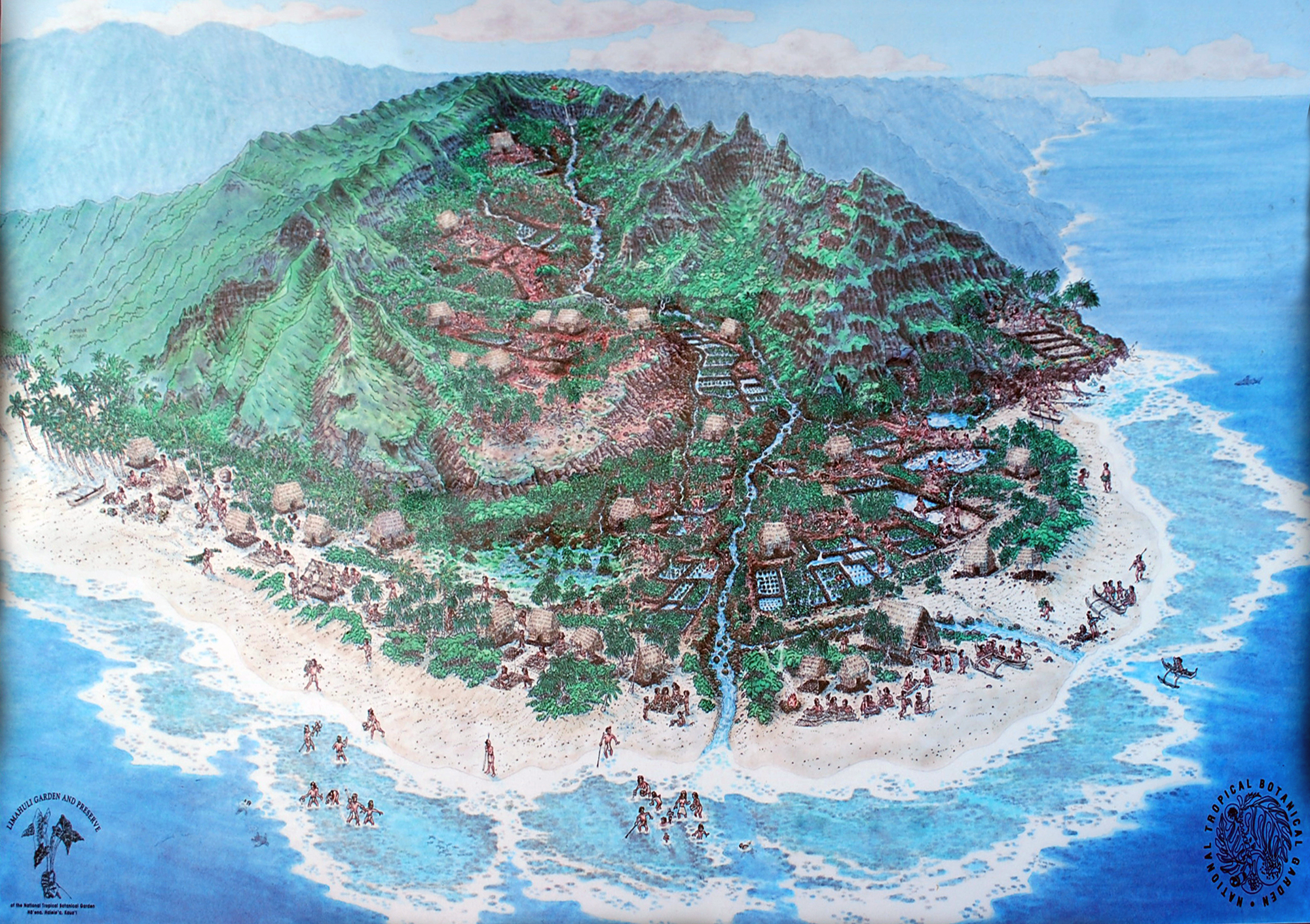
Schematic diagram of how Hā‘ena would have functioned as a working ahupua‘a. Courtesy of Limahuli Gardens.
Hā‘ena is the final land division in the moku of Halele‘a, before the Nā Pali coast inhibits further land transportation. As Carlos explains, “Each moku is further subdivided into smaller land sections called ahupua‘a. The name is an allusion to the akua Lono, patron of agriculture and peace. Pukui and Elbert define ahupua‘a as a ‘land division usually extending from the uplands to the sea, so called because the boundary was marked by a heap (ahu) of stones surmounted by an image of a pig (pua‘a), or because a pig or other tribute was laid on the altar as tax to the chief. The landlord or owner of an ahupua‘a might be a konohiki’ (Hawaiian Dictionary Revised and Enlarged Edition 1986).
“An ideal ahupua‘a extended from the cool, moist uplands, down across the alluvial and coastal plains, out into ocean waters, encompassing fringing reefs and sand-bordered bays. Hā‘ena is the westernmost of seven ahupua‘a in the moku of Halele‘a, bounded on the west by the Nā Pali ahupua‘a of Hanakāpī‘ai ("bay of preserving food by sprinkling salt") and on the east by the ahupua‘a of Wainiha ("hostile waters"). The ahupua‘a was only one facet of a sophisticated land classification system developed out of a desire to create order, encourage peace, and support prosperity. Historic and traditional records provide enough examples of conflict and times of warfare when resources became scarce to inform us that the system was not 100 percent perfect.
“Not all ahupua‘a on Kaua‘i had the same amount of social-ecological zones,” Kawika points out. “The ahupua‘a concept was not applied across the islands in a standardized, cookie-cutter approach; but rather, the implementation of the concept was adjusted to account for biophysical parameters at least. This likely resulted in some ahupua‘a and moku having more abundance of some, but not all, key resources (food, timber and non-timber forest products, passerine feathers, and fresh water) than others.
“However, this system certainly made administering the land easier,” Carlos continues, “by clarifying resource use and designating responsibilities among the different groups of people living on the islands. The traditional system was so practical and efficient that present-day resource management regimes are seriously looking to what is now called the ahupua‘a system as an example of a management system much more suited for the integration needed today for successfully protecting and managing cultural and natural resources in the islands.
“Although a small ahupua‘a, Hā‘ena was well endowed with natural resources. Extending from uplands to coastal plain, it descended from cloud-shrouded peaks broadening out to include a fishery encompassing several large reefs and bays fronting the ahupua‘a. All ahupua‘a in Halele‘a were endowed with well-defined fisheries, the ocean side boundaries of which were demarked by the outer edge of fringing reefs. If no fringing reef was present, the boundary of the fishery would lie approximately a mile from the beach and encompass all of the area shoreward, often areas where spawning aggregations of different species of fish occur seasonally.
“Ahupua‘a life was distinguished by shared use of land and resources, regulated jointly by konohiki (head administrators) and maka‘āinana (the people living on the land). The resulting system included kapu, unwritten rules governing the behavior of people.
“Rights to fish in individual fisheries attached to ahupua‘a were very important to the maka‘āinana. For hundreds of years, unwritten rules passed an ethic of conservation from generation to generation. These inshore areas, the ahupua‘a fisheries, rather than being perceived as open range free to being plundered and accessible to all, were cared for as if they were extensions of the gardens filling coastal plains, stream-lined valleys, and forest clearings in the uplands.”
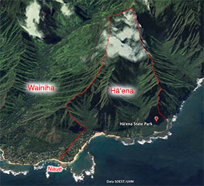
Map showing the projection of Hā‘ena to include some of Naue.
“Naue, traditionally associated with Hā‘ena, is no longer officially located in Hā‘ena ahupua‘a due to the boundary dispute mentioned earlier. It is now situated in the neighboring ahupua‘a of Wainiha. Boundary disputes like the one between Abner Pāki, the original owner of Hā‘ena, and the venerable Ha‘alele‘a, representing the ali‘i Kamāmalu, original awardee of Wainiha, were fairly commonplace in the years following privatization of land begun during the Mahele of 1848. The original deeds conveyed the lands in name alone with no accompanying metes and bounds. Naue, often mentioned in song and story, is located on a point on the northern end of the coastal plain shared by Wainiha and Hā‘ena ahupua‘a. Naue means to move or to tremble. Travelers on boats offshore, in good weather and bad, can attest to that jutting point seeming to move and tremble when viewed from the sea.”
“The division that we knew was behind Violet’s house,” Samson says, “the angle of the back of the her house, shoot straight across to below Camp Naue, Kē‘ē side. And Naue would be in Wainiha.”
“They changed it many years ago because there was some funny things going on,” Uncle Tom remarks. “The Rice’s sold their property on the boundary to Robinson. That’s what my Dad told me. So the boundary moved to a different ‘āpapa, it moved to Kamoa now, so now it runs parallel to our family boundary. Right outside of our place is Wainiha. It runs on an angle to the ‘āpapa Kahaki. But now it runs through Kamoa, the next ‘āpapa on the Ha‘ena side. That’s where our boundary is. So somehow up there the lot is higher than Wainiha.”
|
|