|

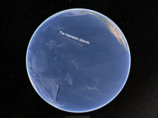
GoogleEarth image showing the location of the Hawaiian Chain.
The Hawaiian Islands are located in the North Pacific Ocean. The archipelago ranges in longitude from 154°48′ W to 178°22′ W, and in latitude from 18°55′ N to 28°27′ N. It is one of the most remote landfalls on the planet, and said to be the most remote archipelago, being over 2000 miles from the next nearest land.
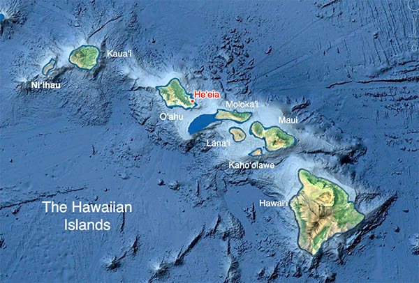
O‘ahu is near the center of the eight major Hawaiian Islands. It is separated from Kaua‘i to the northwest by the wide ‘Ie‘iewaho
Channel, and from Moloka‘i and the other islands of Maui Nui by the Kaiwi Channel. Traditionally, O‘ahu had more in common with Kauai than with the Maui group and the big island of Hawai‘i. O‘ahu is home to Honolulu the state capital and largest city. With 953,207 people, O‘ahu holds about 67% of the entire population of the state, 1,426,393 (2018 census).

The location of He‘eia within the Hawaiian Island chain

Map of the moku and ahupua‘a of O‘ahu.
“Just to explain how land divisions work in Hawai‘i,” Rick says, “you have the entire earth—the honua—and then you have the pae ‘āina, which is all of the islands. And then you have each individual mokupuni or island. We’re on the mokupuni of O‘ahu.
“And within that mokupuni, there are six different moku. We’re in the moku of Ko‘olaupoko. And within Ko‘olaupoko, there’s various ahupua‘a—loosely based on watersheds. And we’re in the ahupua‘a of He‘eia.
"And within the ahupua‘a of He‘eia, there are various ‘ili or smaller land divisions. And then even within an ‘ili, there’s smaller land divisions called kuleana.”
“When you ask most people why is this area called Ko‘olau,” Ian says, “most people say because the mountain range is the Ko‘olau mountain range. It’s a windward mountain range, it catches the trade winds. But it was through this surf knowledge that I came to understand what it really means.

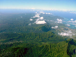
Air view of the Ko‘olau mountains, with Kāne‘ohe and He‘eia to the right. You can see the clouds forming as the trade winds from the right pushes against the mountains.
There’s a type of wave—the rough, steep kind of plunging waves of the east side, short period. Kai ko‘o is the name, just like the surf spot Kai Ko‘o over there on Diamond Head. It catches the last of the wind swell over there, and that’s the last place the wind swells break, wrapping around Black Point on the backside of Diamond Head.
“And then lau is the term for ‘many many many.’ Kai ko‘olau. The whole district is named for the windward side because the wind is blowing onshore and brings up many, many types of short-period, spilling, wind-swell chops—waves of all kinds.
"The story of Kaulu up there it at the point at Oi‘o, battling the great waves on the sea and breaking them into the long and short waves we have today, is pretty much a direct analogy to somebody who understood the dynamics of short-period versus long-period surf and swell.
“And there we get the long-period swell from the northwest that wraps down, the short-period swell from the Northeast that comes across there and even the longest Southwest, the long-period swell will refract, bend around. So Ko‘olau, that’s why we see Tokelau, that’s why we see these other Ko‘olau namesin the Southeast. If you are south of the equator, the trade winds are blowing from there.”
|


