 |
 |
 |
|||||
|
|
|
|
|
|
|
|
|
|
|
|||||||
|
|
|
|
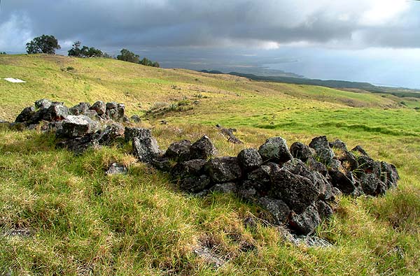
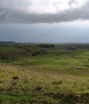
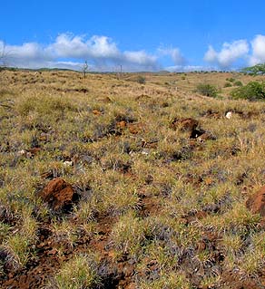
Remains at the Hoepa site, Kawaihae Uka.
|
“In the mid 19th century, there was also a substantial population of Hawaiians at Kawaihae Uka in the uplands of the two Kawaihae (ahupua‘a), probably larger than the population at Kawaihae Bay," writes Charles Langlas, in his 1994 study of Kawaihae Uka. "This upland population lived by farming, probably for the most part growing sweet potatoes in the fields watered by supplemental irrigation. Rainfall in the area is limited and was supplemented by bringing water from the streams by a network of ditches (‘auwai)” (Langlas 1994: 15).
|
||
|
|
||
“The substantial mid-19th century population at Kawaihae Uka apparently derived from an even larger population living there earlier and subsisting on upland agriculture. This substantial population at Kawaihae Uka may date from the late pre-contact period, or it may have developed at Kawaihae port” (Langlas 1994: 16). That a settlement existed here in pre-contact times is attested to by the story of the Kipu‘upu‘u warriors of Waimea—named for Waimea's Kipu‘upu‘u rain—during Kamehameha's battles against the forces of Hilo and Hamakua. “The Kipu‘upu‘u army was divided into various sections," Desha wrote, "one of them being those trained in the use of the bow and arrow, led by a very skilled ali‘i named Waheakalani of Kawaihaeuka [Kawaihae Uka]” (Desha 2000: 196).
|
|
|
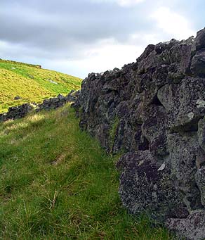
“At least in the nineteenth century, it appears that the upland and coastal populations at Kawaihae were separate settlements and not a single population which moved between the two areas," Langlas writes. "This conclusion follows from the fact that the two Congregational churches at Kawaihae Uka had a stable membership, a membership different from the Kawaihae Bay church” (Langlas 1994: 16). Archaeological survey of the area shows a high density of house sites and probable irrigation ditches in upland Kawaihae 1, much higher than the density at lowland Kawaihae 1 except for the area right at Kawaihae Bay (Langlas 1994: 15).
|
| |
|
|
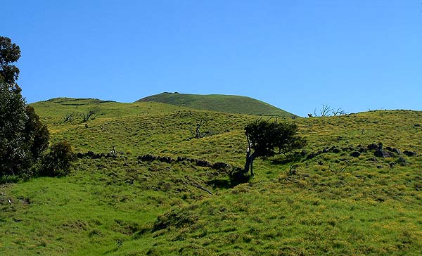
“Kawaihae Uka was a big place, with a lot of people lived up there because of the farming there. The whole Kawaihae Uka was a farming area," Papa says. "Because people got to live, and the climate and ground is so rich there, so that’s why they grow a lot of things. Sweet potato, but no, up there was growing mostly Irish potato, because the elevation is real high. Almost 3,000 feet up there. Sweet potato grows more on the lower elevation. Another thing too, you have the kahawai [stream] right next. Keawewai, that kahawai comes down. "When I was flying to Maui, I looked down and there are these terraces and blocks there, it looks like a farming area. I’d never see that. I see all these terraces, long ones. I knew they farmed up there. But I was surprised. And when we flew back, I could see the terraces running."
|
||
|
|
||
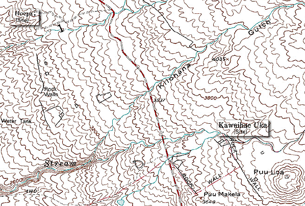
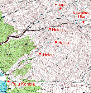
"Our kupuna [elders], they used to live there. They were born there, they were raised there and they worked there. There’s just a line of mountain that cuts across, and this mountain blocks the wind and rain. So it makes sense why they grow up there. Beautiful area. You can really see, they were all farmers that lived up there." “Congregational church records kept by Lorenzo Lyons (the missionary at Waimea) indicate that the upland population fell into two groups," Langlas writes, "each of which built a church in 1861. An upland community called by Lyons Kaalaia (North Kawaihae Uka) built the church named Mauna Horeb, today called Mauna Horepa. The site lies on a gully just north of the Waipahoehoe stream in Kawaihae 1 and is identified today on maps as Hoepa. The community called by Lyons Makela (Kawaihae Uka proper) built the church named Sinai, probably near Pu‘u Makela" (Langlas 1994: 16). |
|
|
A series of heiau are identified on Loebenstein's 1903 map, extending up the mountain to the two Kawaihae Uka sites from Pu‘u Kohola. These do not appear anywhere else. No one in Kawaihae has any recollection of these, but Papa Akau explains their probable use: "Actually it’s not heiau, it’s an ahu where they put things. Because you go further back there, everybody, and especially farmers there, they always give so much to the ali‘i, so they usually put it on the ahu. At a set time, when you bring your goods to pay your tax, you bring things and put it on there, see. Since this is a farm area, so you get so much, that’s the time of Lono. Lono goes that. "Ahu is always where the people live. So just like the tax office, you go to the tax office and pay your tax. So that is just a place, no matter where you live within that ahupua‘a, you always bring your taxes to a certain area. A lot of people say ahu is something for gods and stuff like that, but not exactly."
|
|
|
|
|
“It’s amazing but from Kawaihae to Kawaihae Uka, the temperature was really different." ‘Ilima points out. "You know. we are so used to the heat, we hardly wore clothes at Kawaihae when we were kids. And when we had to go up to Kawaihae Uka, it was the first time we wore jackets because it was cold. And I had an Uncle Alex, they lived there, that was my Mom’s brother. They lived kind of in the pasture up there. “There used to be a couple of houses there, and of course all families that lived there. And until recently, maybe several years ago, one of the Awa‘a grandchildren lived there for awhile before he died. I’m not sure if the house still exists. I think somebody probably bought it and built a new home. But it was just a regular shack. No electricity and I don’t think there was even running water there.”
|
||
| |
||
“Where the old church was, mauka,” Papa says, “the Awa‘a families used to live; all them was mauka side, all in that area.” “My older sister and my parents lived up there,” Pua remarks. “When they first got married and had our first sister, they lived up at Kawaihae Uka. And the Lincoln house, that’s my uncle. The Lincoln family." “Before, we’d go there all the time,” Lani recalls. “My family, the Akaus and Awa‘as, were close, very close. I don’t think it was called Hoepa. I can’t remember the name though. But I remember there was a church there. There were very few people. Very few. The Awa‘as, they’re family: Awa‘a is my mother’s cousin."
|
|
|
"I was afraid when I went up there. And we stayed up there over night, and oh, how gross, this is a terrible place. I would be so afraid to go outside in the evening. One day I was playing outside of the fence, and I thought I heard a pig. And I said to myself, ‘there must be pigs here somewhere.’ I ran up there and I told my grandfather, ‘I think there is a pig out there.’ He said, ‘do you see it?’ I said, ‘No, but I heard it.’ "And for two days he sat there by the fence and he watched. He had the gun, and one day he saw it and he said, Yep, I was right. Bang! He shot it. And then after that he cut it in chunks, got the big barrel and salted it, and put it in the barrel for about a month or so. "Then when they wanted to eat pork, he would go get it and rinse it all off and boil it. First time, you throw the water away; second time, you throw the water away. And then you can cook it, and they put cabbage in it. They would eat it with cabbage—salt meat and cabbage. It was good."
|
|
|
|
"There were horse trails to Kawaihae Uka," Pua says. "Not any more. They barbed-wired this. How we used to go up there, my Dad used to have a weapons carrier, a half-ton truck that belonged to Kahua Ranch, and there was a road that goes all the way up to a certain extent, and then he would go on the mule. And from there he would continue on his traveling, if he was going to go hunting. "That’s the way we used to Kawaihae Uka. That road will take you all the way up to Kawaihae Uka. But you have to hike it, because it’s been years since people used that highway. I’m not sure if the gate is still open. And it’s a steep climb. And that’s our only way of going up there."
|
||
|
|
||
|
|
|
|
|
|

|
| Kawaihae Home | Map Library | Site Map | Hawaiian Islands Home | Pacific Worlds Home |
|
|
|
|
|
|
|


|
|
|||
| Copyright 2006 Pacific Worlds & Associates • Usage Policy • Webmaster |
|||