 |
 |
 |
|||||
|
|
|
|
|
|
|
|
|
|
|
|||||||
| Getting to Tanapag |
|
|
|
|
|
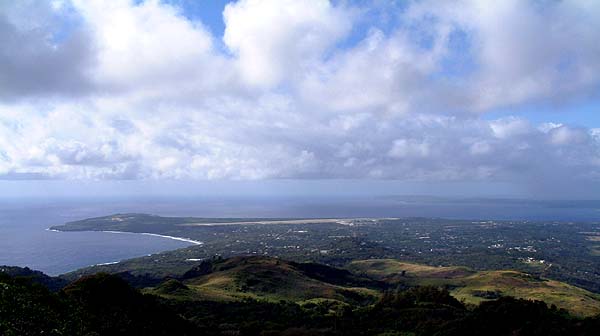
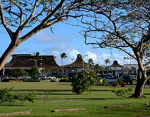
"If one lands at the As Lito Field today—the International Airport for the Commonwealth," Ben explains, "driving up to Tanapag would take, at most, only 20 minutes. For a lot of people who have not gone abroad and have not experienced long-distance travel, 20 minutes is a long trip, particularly if you have to walk that distance, so walking has become extinct, except for exercise. We used to walk a lot because in the olden days we didn’t have as much transportation like pickup trucks or jeeps, but nowadays from the airport driving to Tanapag, crossing all the traffic lights, will still bring you here in 20 minutes or less."
|
||
|
|
||
"Where the airport is, that’s known as As Gonna area, near Ladder Beach and near Obyan Beach. As we leave the airport; there are two ways you can go. If you travel north, first you would probably be going through As Lito, then San Vicente, and As Terlahi. "Coming down the hill you’re going to go through Chalan Rueda, then you’d enter Garapan, and from Garapan you would get to Puerto Rico, and from Puerto Rico you head to As Mahettok. There’s a road going to the right there to up in the hill, to Capitol Hill, better known as Donne’, which is the chili pepper. "And then you’ll find yourself at As Mahettok and on to Tanapag."
|
|
|
"You can also go this way over to Chalan Pi'ao, and that would get you on the boundary line with San Antonio village. San Antonio is a new name for Afetnias. I know I’d rather continue to go back to the traditional names. The Catholic influence has changed a lot of our culture. San Antonio was originally Afetnias, and I’d rather call it Afetnias than San Antonio. "You will cross a boundary between Chalan Pi'ao and San Antonio. And then you can cross Chalan Kanoa. Chalan Kanoa is the capitol of Saipan. We now have a U.S. Post Office. That really designates us as a U.S. area. You don’t have a U.S. Post Office if you’re not a U.S. satellite or in some way attached to the political union of the United States."
|
|
|
|
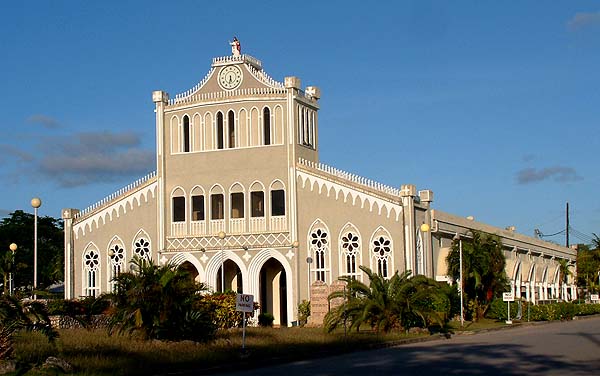
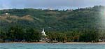
Mt. Carmel Church.
|
"When you cross out of Chalan Kanoa, immediately you would see our famous church of Mt. Carmel. That immediately puts you in Susupe. In that area of the Mt. Carmel church is where they had the sugar cane factory during the Japanese times. They distilled alcohol out of sugar cane, and they made sugar out of the sugar cane also."
|
||
|
|
||
|
"From there you would travel on to what today they call San Jose, but the Carolinian name of the village is Oleai. I guess that maybe a lot of Carolinians there must have been from the island of Woleai in Yap. I don’t like the name San Jose. I prefer Oleai." Farrell's History of the Northern Mariana Islands adds that, "A devastating typhoon hit Woleai on March 29, 1907. It forced about 300 Carolinians to Saipan, where they established the village of Oleai."
|
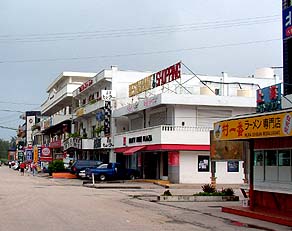
"And then on to Garapan, (Arabwal in Carolinian), which is a district center. Garapan was the center of activities and commerce during the Japanese times. Back then, the majority of the population of the whole island of Saipan lived mostly in Garapan. "There were more than 100,000 people on the island then. And that’s a big strain on infrastructure elements such as water and sewer. Most people didn’t have running water. Most of them had water catchments, and they were happy with that."
|
|
|
"Garapan is also one of the old villages, and it wasn’t as big then as Tanapag. The only two places on Saipan that had churches were Garapan and Tanapag. They must have had fairly even numbers of people back then. "It started out as a Carolinian village, and as more Chamorros returned from Guam, the population increased. The Carolinians centered themselves near the area now called Micro Beach. And Micro Beach is a fairly new name." The Carolinian name is Pian O'lang, "sand, look, sky," referring to star gazing. This area was a sacred site for Navigators. The actual village was further south from where Micro Beach is today.
|
|
|
|
|
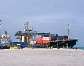
"And from there you will enter Puerto Rico. Immediately when you recognize the harbor, you will know you’ve arrived in Tanapag. There’s no way you can miss that. The harbor area is now called Puerto Rico. And as soon as you reach that, you’re in Tanapag. "You'll be going in through As Mahettok, which is all part of
Tanapag—it’s just a name within the village. "The road will continue past Tanapag to San Roque. That was the last village up north, until recently, when we created As Matuis as the last village now. That’s now actually a larger village then San Roque, due to the homestead program we have here."
|
|
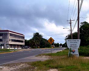 |
"As I mentioned, there are two bridges that delineate the village. So as soon as you hit the first bridge as you’re going up north, you’ll know you’ve entered Tanapag. And when you hit the second bridge as you’re going up toward San Roque, you’ll know you’ve left Tanapag. "When you get to the village proper, the best landmark would be the one that’s been put up by the Chamber of Commerce that says 'Welcome to Tanapag.' ”
|
|
|
|
Entering Tanapag village. An old buoy adorns the roadside.
|
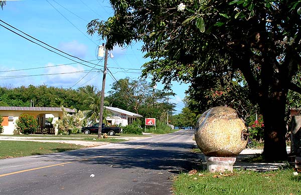
"This road is actually not the main entrance. This is recent. Originally, it was inside the fence of the Lower Base, and so we were not allowed to come in through this passage. Today, though, if you’re coming from the south going up north, this is a good place to enter the village.”
|
||
|
|
||
|
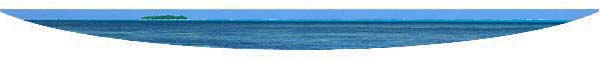
Now you are ready to arrive in Tanapag Village.
|
||
|
|
||
|
|
|
|
|
|

|
| Tanapag Home | Map Library | Site Map | Pacific Worlds Home |
|
|
|
|

|
 |
|
|
|||
| Copyright 2003 Pacific Worlds & Associates • Usage Policy • Webmaster |
|||